Tuesday, November 20, 2012
Ride Across Britain - Postlude
There was no wake-up call in the morning and the thought of missing the bus was quite frightening, so I set all my alarms. There were a lot of hungover people around the camp site, not surprisingly. One final breakfast, and I have to say they were all very good, and onto the bus. The itinerary was Inverness airport, the hotel at Inverness where some lucky people, without bikes, had spent the night, Edinburgh airport, Newcastle train station and finally York train station. I had opted for Newcastle. Given where I was heading, there was no benefit of going to York as trains are faster than buses (in the UK anyway).
We started late and basically lost time at every stop, so I had missed my scheduled train by the time we arrived at Newcastle. Fortunately my ticket was good for several subsequent trains and there was one leaving in about 10 minutes. In comparison to the bus, the train was sublime. Fast, smooth and quiet. The only downside of the trip was that the connection to Northampton terminated unexpectedly a few stations short owing to electrical problems on the overhead lines. A bit of a panic, but we were instructed to board a Virgin train heading to London, get off at Milton Keynes, and then catch a local train back to Northampton. The Virgin train was seriously fast and in the end, I lost very little time. A 15 minute taxi ride and I was back "home", at the house of my mother-in-law, at about 9pm. So a 14 hour day, but mostly spent in recovery mode. The next day we were off to the Harry Potter studio exhibition near London, and then flying back to San Francisco the following day.
So how do I feel about the whole event now that it's (long over)? Well, overall, it was a great experience and I was happy that I actually felt stronger at the end than the beginning. I wonder whether other people felt the same. I had thought and, indeed opined on the RAB rider hub website, that we would all be steadily draining the tank as the days passed, getting a bit more tired and, correspondingly, a bit slower each day. This was based on my experience from multi-day randonneuring rides. However, for me at least this was not the case, almost the reverse in fact. The neck and shoulder problems I suffered with at the beginning got steadily better. I put this down to there being an adequate recovery time on each day of the ride. I was firmly in the middle of the rider pack, time wise and, perhaps if I had been at the back, with more hours on the bike and less recovery time it might have been different. Certainly, multi-day randonneuring rides do not have anywhere near adequate daily recovery time, they are basically an exercise in survival. I know some riders would have liked a recovery day, basically a really short mileage day, but clearly that would either make the other days tougher or extend the number of days, and it is already quite long.
The fact that I was already an experienced endurance cyclist obviously helped and there was nothing on the ride that I hadn't faced before in some form. Even the long day was really "only" a 200K brevet. None of the climbs compared to those in California in terms of length and gradient. The first day was hard because it was relentlessly up and down, but I had recently done the Mount Tam double century, which has a similar profile. So this speaks to the importance of appropriate training for the event. Although I didn't follow them, because I had my own plan, the monthly training plans provided for RAB looked really good and I am sure that anyone who followed them was similarly adequately trained.
The organization of the ride was outstanding. Even in the flooding crisis at Penrith, the organizers pulled it off. Many people have already commented on this, but I will also note that the attitude of the staff and volunteers was extraordinarly positive. One could forgive the people filling bottles with Powerade day in, day out, for getting a bit glum, but if they did, they didn't show it. It was just amazing how friendly and smiling the staff were. Perhaps this had something to do with the riders. My experience is that endurance cyclists are a pretty easy going bunch and not wont to complain. Certainly, everyone I interacted with, riders and staff, seemed very likeable, and I have been on rides where this is definitely not the case. No Prima donnas on RAB!
I liked the route overall, although some of the "green lanes" in England were a bit tricky and the urban section from Haydock was truly awful but might be better in the opposite direction, as it wouldn't be in the early morning rush hour. The road surfaces in southern Scotland were bad, but the north of Scotland was great, and overall my favorite part of the ride.
I met a lot of very nice people on the ride, not least the entire Bigfoot team. One of the features of the catering tent was that you were pretty much forced to sit with someone new at every meal, so the opportunities were always there to meet new people. One thing that I think would be a good idea would be to provide a rear-facing bike tag with the rider's name on, in addition to the front facing numeric tag.
One thing that didn't go very well for me was fundraising. I didn't go into RAB thinking of it primarily as a fundraising ride, unlike other rides like the Multiple Sclerosis Waves to Wine ride, that I have done a couple of times. Instead I viewed it more as a tour, since I was paying a significant entry fee. However, it was clear that fundraising was a big thing for many of the riders, and the organizers stressed this a lot in the daily briefings. My fundraising started well with close friends and family, but I drew a complete blank from email solicitations and Facebook posts, even from people who I had sponsored on their rides. Possibly there are now so many fundraising rides that people are burnt out and/or just don't respond except to direct requests.
So, if you are thinking about doing RAB, I can certainly recommend it, provided you are prepared to do the training. It's a unique experience that you won't forget. Will I do it again? Perhaps, especially in the other direction, but not next year as that's just too soon, and there are other rides out there!
Monday, November 19, 2012
Ride Across Britain - Day 9
Once again, I set off in the company of the Bigfoot train. Sure enough it started raining almost as soon as we set off, but it wasn't torrential. I had fenders (mudguards) on my bike but surprisingly, given the probability of rain, very few British riders did. That meant that group riding was at bit unpleasant at times when the spray from the bike in front hit you in the face.

After passing through a few small villages, we entered the moorland and settled into a long very steady and slight ascent to just under 900'. Although we were nominally on an "A" road, it was single track in places. We were in Sutherland now and probably contributing significantly to its total population. We really were a long way from anywhere populous by this stage.
By the time we reached the summit, the rain had stopped and there was serious brightening of the sky to the north and east. The descent was steady, a bit steeper than the ascent, but the temperature was only about 7C (45F).


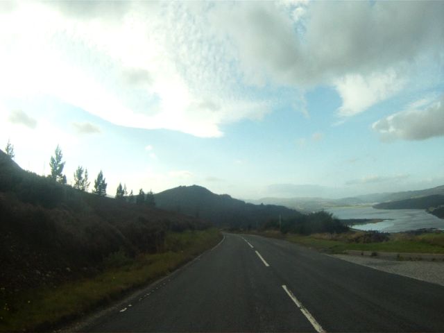
The road was doing a lot of short ups and downs as it wound its way alongside the Loch and eventually I started to warm up. The sun was coming out so I stopped to lose some clothes and also decided to drop off the Bigfoot train and ride a tourist pace. The valley went on for about twenty miles before we reached the coast. It was at this point that I realized I was quite confused about the direction we were taking. I had assumed, wrongly as it turned out, that we would follow close to the east coast. In fact we had gone due north and had reached the north coast. Scotland at the top has a long straight north facing coast that meets the east coast at John O'Groats. So whereas I thought we would be turning left, instead we turned right.
What followed was a long series of small climbs and descents, seven in total, spread over about 30 miles along the north coast. The first climb was about 400' and the rest about 200' each. At the start we went through a small village with an unlikely name. Here we were, nearly as far from the English border as you get, with most place names sounding very Scottish, e.g. Altnaharra, with a village called "Betty Hill". According to Wikipedia, the Scottish name is Am Blàran Odhar.
Towards the end of the seven hills was the second rest stop in the car park of a hostelry of some sort, and lots of people were inside including, it turned out members of the Bigfoot train. I didn't stop beyond picking up supplies and they passed me some way down the road. The train seemed to have lost a few carriages. Unfortunately, one member was suffering knee trouble so they were coming in at a slow pace.
The remainder of the ride became progressively flatter as we approached John O' Groats. We passed by the Dounreay Nuclear power stations, now decommissioned and then went through Thurso, the main town of note in the areas, before the final very straight and flat run parallel to the north coast. Finally we turned north and rode down to the finish arch at John O'Groats. Lots of noise and my name being announced on a PA system.

After the congratulations and being presented with a medal, it was time for the matching photo to that at Lands End. I was lucky that the line was pretty short as the whole procedure took quite a while.

It was still early afternoon but, much as I might have wanted to just take it easy for a while, I had the bike to pack up and, knowing that it always takes longer than I think, decided to get started right away. Most riders were boxing their bikes up in the car park, but I found a nice spot on some grass adjacent to the finish arch. So I could hear the riders being announced on the PA while I was packing. I had great views of the coast and the Orkney Isles just to the north.
Everything went well to begin with but I had some problems with the fit in the case. The problem is that there really is no margin for error, everything has to be in exactly the right place for the lid to close. After a few retries, I was satisfied and it was time to go and get a shower at one of the shower trucks that they had brought up. Talking of showers, the threatened late afternoon rain shower showed up while I was waiting in the queue. It was pretty intense and we all took refuge under the cover of the snack area. While in the queue I got chatting to a guy who had done the ride on a Bike Friday. He was a Deloitte partner and had done the ride previously and felt he needed a slightly different challenge this time. He survived the ride but one of his knees was unhappy from spinning the small wheels of the Bike Friday.
Just about everyone except the people like me going back to the Kyle base camp had departed by now, either in taxis to Wick airport or buses to Inverness. Our bus didn't leave until 6:30, and the small cafe was doing a great business, unfortunately running out of beer. An enterprising fellow had set up a stall across the road and was selling Stella Artois out of a box. I took his last few bottles at a price, but it was worth it.
It was nearly three hours back to Kyle, along the east coast road, so there was very little time to do much beyond eat. The caterers had put on a full Sunday roast dinner, which went down very well. It felt strange for the usually buzzing tent to be so empty. I went over to the chill-out tent afterwards, where some serious drinking was getting started, but I was wiped and, since we had to be up for a 7am departure on the bus, I bailed and went to the tent. It was good that I was very tired as the camp staff and perhaps some of the riders were partying very heavily, including Karaokee, until the small hours. I slept through most of it.

Saturday, November 17, 2012
Ride Across Britain - Day 8
As luck would have it the Bigfoot train was on the starting grid when I arrived. So I joined in and it turned out that the first section of the ride was very conducive to fast group riding. We were essentially traversing Scotland diagonally from south-west to north-east along a massive straight fault containing Lochs, including the famous Loch Ness at the end. Shortly after the start we rode along the rather strangely named Loch Lochy and then briefly through a loch-free section to the base of Loch Ness at Fort Augustus. The main A82 road, which we had been following since Ft William, crosses to the north side of Loch Ness at this point. RAB 2011 had ridden south on that section and it had been a problem traffic wise. So this year we climbed the hill to the east on a minor road.
It was getting warmer and it wasn't far up the short but steep climb that I had to stop to strip off some clothes. The rest of the Bigfoot train didn't feel the need and kept going. They were climbing faster than me anyway!

After the initial steep climb it flattened for a while with some nice scenery. Somewhere along here we met bikes riding the other way in some kind of race; at least they were sporting numbers on their bikes and riding quite hard.

One final climb and then we seemed to be on the top of the world with a fantastic looking descent ahead of us. There were a couple of disabled riders on extremely low recumbents getting ready to descend and hoping to hit 60mph!


The initial descent, basically dead straight, was 4 miles long. Not terrifically steep but I was averaging about 30mph.

At the bottom was the first rest stop of the day, where I ran into the Bigfoot train again, and left with them. The descent continued, but became much twistier, which was tricky as the road was basically single track and there was some tourist traffic. Eventually it straightened out as we got close to the Loch level. Unfortunately there were no great views of Loch Ness because it was shielded by a thicket of trees.
The road continued on, basically straight and flat, into Inverness, which is on the east side of Scotland. Inverness is near the end of the Beauly Firth which has its outlet in the North Sea. The main A9 road from Edinburgh crosses Beauly Firth at Inverness on its way north, but we went around, which meant heading west for a while. That, unfortunately, took us back into a headwind. Two of the Bigfoot train "engines" distinguished themselves on this section, pulling us along at an amazing pace. In fact, a bit too much for me even with the draft. I was very happy to reach the next rest stop when we finally swung around to the north again and reached the northern side of Beauly Firth. I grabbed the food and went and crashed on the grass. It was pleasantly warm out of the wind and I decided to take a break from the Bigfoot train and ride at my own, slower pace, for the rest of the day.
The next piece of water was the Cromarty Firth, which we rode parallel to for quite a while. The main road, which we were also paralleling, went east and north along the coast, but we, of course, struck off due north over the top. It was still quite warm at the start and the roads were really quite traffic free.

Eventually we climbed up to a plateau at about 800' where the weather was a lot cooler and windier. I had a moment of foolish complacency where I was riding no hands trying to open a packet of Jelly Babies, from the rest stop, when a gust of wind came sideways out of nowhere and practically tipped me over. I survived but, sadly, the Jelly Babies didn't.

In a reminder of how the weather can change fast at altitude, the sun went in and the temperature seemed to drop sharply, enough to make me stop and put more clothes on. But soon we were descending down to Dornoch Firth and Bonar Bridge, with the base camp not far away, and the temperature warmed right back up again.
After crossing Dornoch Firth, we made a left turn and a few short miles into the base camp, which was the most spectacular location since Lands End.


Friday, November 9, 2012
Ride Across Britain - Day 7
Evidently the rationale for the very long day was that the organizers wanted to avoid the Glasgow traffic at the end of day 6. Not clear that was the right decision as day 6 was very fast and most people would have been able to put on a few more miles. And it turned out that we by-passed Glasgow so the traffic was really quite light, certainly nothing like the exit from Haydock. The worn chipseal was still in evidence however.
Eventually we left the urban area behind and headed out into the fine Scottish countryside. To our right was the range of hills that we should have climbed over but we were going around them.
The main weather front had definitely passed through overnight and we were in the showery period. The sun was making a showing and I couldn't find the right clothing level. I remember stopping in Callander to put on my rain gear because I could see a big shower ahead only for it to move off in a different direction. Then we started climbing and I was getting uncomfortably hot, so off with some clothes again. The climb was over the north side of the Trossachs and it was quite spectacular.


At the top, we were in the mist again and it looked like a long descent, so back on with the clothes! After turning back south east into Crianlarich, we began the climb up to the Bridge of Orchy and Rannoch Moor. The weather was definitely improving and I was really happy with the lack of wind because I had expected Rannoch moor to be truly windswept. However, this turned out to be entirely due to the windbreak provided by the hill on west side leading to Glencoe. As we crested the summit at 1300', the change in weather was quite dramatic. The wind was blowing hard and it looked very grey and wet down the valley. So back on with the clothes again. I was glad I did because the descent made the headwind we had coming off Shap seem like nothing. I was pedaling downhill and managing all of 9mph. The problem was that the descent was very, very long. I started to get quite cold even with the windproof jacket. Towards the end of the first part of the descent I jumped on a 3-man train for a while; they were making 15mph. Unfortunately, I simply could not hang on even with the draft. The train leader was one strong cyclist.
As we passed Glencoe village, the road started climbing again at a couple of percent grade. Since the wind was still blowing, this did not help. Fortunately it didn't last long and the road crested and entered a narrower valley which had more shelter from the wind. I stopped to eat some chocolate and take in the scenery at a big turnout. As I was just getting ready to go I spotted the Bigfoot train coming down the hill. I scrambled to turn around and get back on the road and started to chase them down. It was incredibly difficult to catch up and I was pretty much out of gas when I finally caught the draft. That helped enormously of course and I was able to settle in. It turned out that another group had merged in with Bigfoot so it was a very long train.
Even though the wind had diminished as we descended the valley, I was incredibly happy to have the protection of the group. It was still a long way to sea level at Loch Linne but we were moving along at a fine clip. Shortly before the right turn up the Loch to Fort William, there was a final mini rest stop with one ration of cake per person! Funny, I can't remember anything about the other rest stops on this day.
The group was in good spirits as we sped along the side of the Loch towards Fort William. It was flat and the wind had died so we made good time. I even took a turn at the front for a while!

Once again the camp was on the other side of the town. It was a tired but happy group that rode in to the cheers at the finish. Pretty long ride, 10:30 actual riding time, just under 12 hours total ride time. The camp was close to Ben Nevis but it wasn't visible due to the cloud cover.
After showering, it was my day for the massage, which felt good. Then food and sleep. Weather forecast good for day 8, thankfully!

Tuesday, November 6, 2012
Ride Across Britain - Day 6
The camp hadn't dried out much overnight, but I was happy that they had arranged for an alternate exit from the bike rack area, so I didn't start the day with wet feet. It was a flat straight start so easy to maintain a good average speed. The route mostly paralleled the main A74 road and wasn't particularly scenic.

The weather forecast was for mostly dry conditions, but it was cool enough to be wearing the jacket and the leg and arm warmers. There were fine views to the east of Cross Fell, the highest point on the Pennine hills that run down the spine of England. I had nostalgic memories of my backpacking trip on the 270 mile Pennine Way in 1969.
We then descended a few hundred feet into Carlisle, the last large town in England on the west side, and it wasn't long before we crossed into Scotland at Gretna.


I'd been warned by a Scot at breakfast that the road surface on the old A74 in Scotland was bad and he was right! This is the problem when a new road is built parallel to an old one; there is little incentive to maintain the old one. So it was back to worn chipseal and I'm pretty sure it was worse than the bad stuff in Devon. At one point I was so annoyed with it that I stopped to take a photo and post it on Facebook!

The photo doesn't really tell the full story as it needs to be 3D to see the depth of the area were the chipseal has worn away, but it was 3/4" on average. All those light colored areas are holes.
We'd been climbing very steadily since Carlisle and had hit the 1000' point twice as we crossed the Pentland Hills. It was pretty windy and mostly a crosswind or a headwind.

Eventually the descent into the Glasgow area began and I was very fortunate to be able to jump on the "Bigfoot" train. Bigfoot is the cycling club that Hugh Webb, who I had met on day 1, belongs to. Hugh is an excellent organizer and had arranged several multi-day training rides prior to the event, including a trip to France and, in the process, formed a group that pretty much rode all of RAB together. Not everyone was a Bigfoot club member, and they had picked up some extra people on the way. The original group were distinguished by tags hanging from their saddles, that Hugh had had made. By this stage the group was about 40 strong when everyone was together and it rode two abreast at a good clip. The group had some very impressive "engine" riders. Not everybody took turns at the front because the engines were so strong.
My neck and shoulder issues had faded quite a bit by this stage, so it was actually comfortable to ride in a group. Given the pace the Bigfoot group rode at, I wish I had been able to join earlier but really there was no way I could have ridden at that pace in the first few days.
So it was a very fast ride in to Hamilton. Road works required a bit of a diversion towards the end and, to avoid crossing a busy road, we had the frustrating experience of having to ride past the base camp entrance down to a roundabout, and then backtrack.
Apart from the poor road conditions this was the easiest day by far and it was nice to be in so early and have plenty of time to shower, eat and hang out. Hamilton racecourse was more like Ludlow than Haydock in size, but it was at least very compact so only a short walk from the tent to everywhere important.
The briefing, however, was sombre affair, as the forecast for the next day was pretty horrific. This was the long day, nominally 127 miles, and over Rannoch Moor and through Glencoe pass. Unfortunately a landslide had closed one of the roads which meant a detour adding another 7 miles. The only good news was that we would miss a climb in the process. Many riders were, rightly, intimidated by the prospect as this would be considerably longer than any ride they had done previously. This was the time when I was glad I had lots of experience riding such long distances.
The weather forecast was not good, lots of wind and rain early. In fact it was already blowing a gale at Hamilton and the rain started shortly after the briefing. To get as many people as possible through to the finish on their bikes, the start time was moved up to 6:30, so a very early breakfast at 5:00. Just like a 300K brevet! It was pretty hard to get to sleep as the tent was being buffeted by the strong winds, but it happened eventually.

Saturday, November 3, 2012
Ride Across Britain - Day 5
It rained overnight and was still raining, with the forecast for rain all morning. As I was packing up my gear, I discovered that I had lost one of my finger gloves, which I usually wear first thing, or if it's raining, as they have nylon "oyster claw" covers that help keep the gloves dry for a while. But my luck was in! I must have dropped it last night on the way over from the bike rack and someone had picked it up and handed it in to the lost and found.
A big breakfast in the spacious dining area in the pavilion and then on with the rainlegs, waterproof shoe covers and Showers Pass rain jacket and waterproff helmet cover (in lurid dayglow green!). The start was ok, but then things took a big turn for the worse. We were stuck in rush hour traffic that basically went on for two hours before we escaped the urban jungle between Manchester and Liverpool. I think I averaged 10 mph for the two hours.
One unusual sight (for a Californian) was literally hundreds of school children walking to school, or waiting at bus stops, in the rain. Evidently, British parents aren't inclined, at least in this area, to ferry their kids by car. Given the traffic, one can perhaps see why.
The first rest stop was at a garden center and there were a lot of wet, cold and miserable people hanging out there. Since the weather is Britain frequently wet, I was a bit surprised with the amount of complaining going on. But I guess there are a lot of fair weather cyclists everywhere. After all, who chooses to go out riding in in the rain? Not me, for sure. It's only when commuting or on rides like this where you have no choice that you get to come to terms with it. And it's actually not that bad provided you have good equipment.
Then it was into the countryside on the run up to Lancaster. I knew this area well from my undergraduate days at Lancaster in 1970-73. The countryside is great and only gets better as you get closer to the Lake District. The rain was beginning to ease off, but the sky was still very grey. It was also getting a bit hilly. The second rest stop in Kendall (I think) was a similarly dismal affair, and it was raining again. In previous posts I forgot to mention the rice pudding option, surprisingly good on a bike ride. A bit like oatmeal. Since the Shap climb was coming up, I loaded up on chocolate and energy bars. The Tour of Britain race had been in this area today but we were too late to see the racers.
Fortunately the weather took a turn for the better on the climb up to Shap. The clouds parted and the sun came out. I stopped to remove some clothing as I hate getting hot when climbing and someone kindly took my photo, wearing my California Death Ride jersey.

Talking of riding jerseys. Based on what I saw on RAB, the culture in Britain is evidently very different from California, where sporting jerseys celebrating big rides is de rigeur. On RAB, apart from the large percentage wearing the RAB jersey (day after day - I hope they were washing them), most people were riding in simple plain jerseys or professional cycling team jerseys, like Sky. There were also a lot of team jerseys, e.g., Cisco, UPS. I had worn my SF Randonneurs jersey, with the Golden Gate logo on day one and my California Triple Crown Gold Thousand Mile Club jersey on day two, and the Death Ride jersey on day three, partly hoping that they might be conversation starters. Of the three, the Death Ride jersey got the most comments. The SF jersey was pretty effective, people being quite surprised that I had come all that way to do the ride. But the Triple Crown jersey elicited zero comments, and I think it was just way too braggy for the UK culture, so I never wore it again.
Anyway, back to Shap. It's not a difficult climb and the scenery is great. The final long straight stretch where the road is cut into the side of the hill reminded me a lot of La Rochelle on Paris-Brest-Paris, and the altitude is also similar, about 1400' at the summit.


There was quite a crowd at the top and everyone was looking forward to the descent. Unfortunately, there was a headwind which rather spoiled it.
After the descent we reached the town of Shap itself and I spotted lots of bikes outside a pub so, feeling a bit chill and tired, I joined them. Ran into Richard and Vicky but, unfortunately, they were just about to leave. Had a fine cup of tea and then set out for Penrith. It was an easy ride in, but the base camp turned out to be several miles past Penrith.
The base camp was in the grounds of what seemed to be a large country house. In normal conditions, it would have been idyllic. However, these were not normal. We were advised to walk through the finish arch owing to the mud. It didn't seem too bad but then things took a serious turn for the worse. My feet had dried out on the ride in, but as I turned into the bike rack area I sank into the marsh and the muddy water came over my shoes. Really nasty. The tent registration area was pretty boggy and I was very happy to find that my tent was on higher ground. But still, it required careful navigation to avoid the boggy bits. And that was the story of the whole camp really, it was necessary to carefully pick your way around the truly boggy sections.

It was pretty amazing that the camp was functional at all given the surface conditions and I was wondering what the catering tent was like. The good news was that they had put down a wood floor. I have to hand it the Threshold team, they did an amazing job under the circumstances. My wife Jenny and sister Anna were supposed to be meeting me at this camp but my cell phone had no reception. I managed to borrow a phone that did and found that they were still en route from Sheffield as there had been an accident on the A66 across the Pennines. I warned them about the conditions and wasn't even sure they would be able to get in with a car.
One casualty of the conditions was the shower trucks; they could only get about half of the trucks into the site. So the shower line was really long. I decided to eat and hope it thinned out later. Just as I was leaving the catering tent, I spotted Janny and Anna. Evidently, there was a back road in that avoided the bog.

Given the late hour and the fact that I had just eaten, plans for the a night out in Penrith were abandoned. We hung out for a while in the chill-out tent and then picked our way carefully back to my tent as I wanted to get ride of some unneeded clothing that I was tired of trying to stuff into the rucksack each day.

The ladies were anxious to get to their B&B in Penrith, as they hadn't had time to check in on the way in, so we said our goodbyes in the failing light. They would start heading back south the following day as I continued north. It was a shame that they couldn't be at there the finish but Anna had to get back for work and it's a long drive from John O'Groats back to Devon.
The shower lines were still long so I decided I was going to skip it. Fortunately the day had been so wet and cool that I didn't have that sticky feeling you usually get after a day on the bike. I was tired of picking my way around the bog so also missed the briefing. I was close enough to hear sound from the tent, but not close enough, unfortunately, to hear the details of James Cracknell's stories that were, by other accounts, somewhat blue.
So, over half way.

Thursday, October 25, 2012
Ride Across Britain - Day 4
The day starts with some climbing to skirt the Stiperstone hills. I realize that my GoPro camera is low on battery because it keeps turning off after a few seconds. Since I have a eWerk charger connected to my dynamo hub (another randonneuring feature of the bike), I have been charging two 2000ma cache batteries continuously. I remove the GoPro from its protective waterproof cover and attach it to the charger. Unfortunately I evidently failed to tighten the bolt back because when I get to the first rest stop I discover the bolt has fallen out. So no more video today.
The rest of the day is pretty flat ride across the Cheshire plain. The bad news is that there is a headwind/crosswind which makes the going slower than you would like. It's also quite chilly.
One of the features of RAB is that the route generally stays away from big towns and cities, so it is a bit strange to come to a main road crossing and see a sign for Manchester. Hard to believe that we've come so far north in just four days.
Then I saw this banner!

It belonged to Mr Gambatte, who had done the ride last year and loved it so much he was moved to created the banner and come out and support the riders. We chatted for a while and he loved the fact that I had come over from California to do the ride.
Shortly afterwards we cross the Manchester ship canal over an old creaky toll bridge (free to bikes!).

Then it was the run into Haydock Park. At which point my Garmin went haywire and started insisting I make as U-turn as I was off course. It had lost the course on a number of previous occasions and then later announced that it had found it again, but this insistence was unusual. In addition, it also coincided with a long stretch without any of the RAB directional signs, so I began to take it seriously. Since we were in a built up area with shops, I stopped and asked someone if we were on the right road for Haydock Park. The news wasn't convincing. The answer was yes, except if I was a car driver the answer was not really, because a car would have taken the left on the main road that we just crossed. Since that was a seriously busy road I decided to continue. After a while, a RAB sign appeared but then I got paranoid thinking it could be a tomorrow's sign leading away from the camp! Fortunately it wasn't and we eventually entered the racecourse through a back door entrance.

Haydock was indeed a much more impressive place than Ludlow, with a huge stand. The tents were across the finishing straight, which had been covered with a walkway to protect the course.

I just barely got to my tent before the shower that had been threatening for a while hit the site, so I stayed in my tent while it blew over, before heading to the shower. The next order of business was to see if Halfords could help me fix my GoPro. Fortunately my handlebar mount had a second plastic tightening bolt that didn't need to be adjusted ever, so I figured if I could get a fixed bolt I could replace the one I lost with that. And indeed Halfords found a suitable bolt, so I was back in business.
The catering facilities were to a very high standard, including actual linen tablecloths and servers dressed in fancy uniforms. The food was pretty good too! The bad news at the briefing was that the weather forecast for the next day was bad; steady rain in the morning, possibly clearing later in the day. There was even worse news about the base camp at Penrith. Evidently, the area had experienced biblical amounts of rain in the last couple of days and the site was currently a swamp. Oh well.

Tuesday, October 23, 2012
Ride Across Britain - Day 3
Today was the shortest day, only 99 miles to Ludlow race course. We descended into Bath, which was basking in the morning sun, and then climbed the hill on the other side of the town.

It was a tough climb out of Bath that early, and after a larger breakfast than I usually have before rides, but we eventually reached a plateau that ultimately descended to the Seven estuary. It was clear that we had left the sleepy south-west behind us; there was a lot of traffic heading to work, probably in the city of Bristol, and the roads really weren't suitable for drivers in a hurry and 500 bikes at the same time. Some of the drivers were clearly quite frustrated.


Briefly, we enter Wales and hit the first rest stop in Chepstow, which has an impressive castle.

Then back into Gloucestershire, England and a climb up to the Forest of Dean. The weather is deteriorating and sure enough it soon starts raining. Nor does it look like a "shower", its pretty heavy and it looks to be set in for a while. I pull off to put on my vest but I'm ruing the decision to not bring the real rain gear. I get pretty darn wet pretty fast but bike gear is a bit like a wetsuit, so you don't get that cold, which is important. The worst thing is not having the waterproof shoe covers and my feet are swimming. At least I have two pairs of gloves so I can keep one pair reasonable dry.
The rain lasts about 20 minutes, which I suppose counts as a shower. Perhaps it's coincidence but I notice that my fenders are loose. The front is easy to fix but it turns out that the screw holding the rear fender to the frame at the brake has dropped out. I tighten everything as best I can but the rear fender is destined to bounce around requiring periodic re-tightening.
We enter Herefordshire and ride alongside the River Wye. This is a part of the UK that I have never visited before and I have to say that it is very picturesque indeed. We skirt the town of Hereford and then go off into the Green lanes again. One scary moment after rounding a bend to see the entire road covered in sand and mud. Fortunately I'm not going fast.
Finally back onto proper roads and the easy run into Ludlow. Through the town and a few miles on is the racecourse and the base camp. It's quite small but has a nice feel to it. The weather has dried out completely now but I decide it's time to get my fenders properly fixed as it surely is going to rain later in the week. I decide that a small zip tie will hold the rear fender just as well as the bolt did. I also switch the front and back stays fixing the initial assembly error at Lands End. One problem messing with bikes on grass is dropping a small part and sure enough I drop one of the stay bolts and spend about five minutes before finding it!
It's massage day again and also laundry day. There's a laundry service here and then every two days. You can get two jersey and two shorts washed, which means you only need carry three sets of kit. There is also an on-site drying tent and a lot of people do their own washing and dry it overnight.
The catering is being done by the same crew as we had at Lands End and it's just as good. Since I managed to find a seat close to the front I actually get to see the people involved in the briefing, for once. Tonight, Rebecca Romero, Olympic gold medalist in rowing and track cycling, regales us with the story of her attempt to break the LEJOG record non-stop on a tandem with Threshold co-founder James Cracknell. They didn't quite make it, but rode 50 hours before Rebecca's knee gave out. No doubt this challenge would impress some of my more extreme ultra-cycling friends, but the knee issue just reminded me that pushing yourself that hard is insane!

Friday, October 19, 2012
Ride Across Britain - Day 2
My friend Mike had actually got out of bed and walked up to the start to wave me off, unlike my good wife! I just managed to spot him and call out as I was passing, else I'm sure he would have missed me as he was on the far side of the road with about twenty riders in the group.
A few years go I would have gone out without arm and leg warmers, knowing that the forecast was for a slightly warmer day. However, my knees don't like anything under 15C these days, so I was dressed for cool. Good thing too because, shortly after leaving Okehampton we climbed into the mist and it felt really quite cold and damp, especially as were now riding on a plateau so making a good speed.

Rest stop 1 was in the village of Bampton, where we encountered a big traffic jam entering the village. It turned out that a herd of sheep was being taken through the center of the village! The rest stop was just after the barn they were heading for so you can imagine the chaos. Not a good time to be in a car.

The rest stop was pretty crazy, being on two sides of the road just after a narrow bridge over a river. There were bikes and bodies everywhere but, happily the lines for drink and food moved quickly. Since I had missed the first rest stop on day 1, it was a pleasant surprise to find that "lunch", by way of a variety of sandwiches, was part of the fare.

I met a young girl on the bridge eating my sandwich and asked her how her ride was going. It turned out that she had only started riding in April, and here she was aiming for nine centuries in a row. The optimism of youth!
Sometime after the rest stop, the road surface deteriorated, and these were fairly main roads. Lots of badly worn chipseal made for a very bumpy ride. It seems that UK highway builders use a larger chip than in the US, around 3/4". So when the tarmac in between fails, the resulting surface is much bumpier. Since my left shoulder was also complaining I wasn't very comfortable on the bike. I was trying to keep my left elbow down to keep the trapezium stretched out, but it wasn't easy.
A little further on, we entered Somerset.

However, this was just a warm up as up next was the crossing of the Quantock hills.

We didn't have to enter Bath proper as the University, where we were staying, is on the south side and, feeling pretty good, I rolled into the finish to be greeted by Jenny and Anna again and Bee and Stewart, old friends who live in Bristol. A bit of a panic though, as Anna had almost run out of fuel in our hire car and couldn't get it started! Jenny, Bee and Stewart had also had a frustrating time going in circles and following the route signs for the next day trying to find the finish!
All I wanted to do was get a shower and something to eat, but first I had to get my room sorted. The room was great, quite new with en-suite shower, but it was on the fourth floor and no elevator. My legs didn't really appreciate that.
After the shower, we went off to find Anna and the car and, of course, it started first time for me! These hybrids can be tricky! Apparently Bath is built on an old volcano and certainly the hill dropped off very steeply to the south, where we went to get some fuel. At the garage I spotted a RABer who had sadly taken a wrong turn, waiting for a ride to the finish - he was done.
Another night playing hooky at the pub, with one pint of real ale this time, and then actually back in time for dessert and the daily briefing, and off to a real bed.
